StarboardBeam.com - Weather

Welcome to StarboardBeam.com

Portholes into the Phenomena of Weather

storm

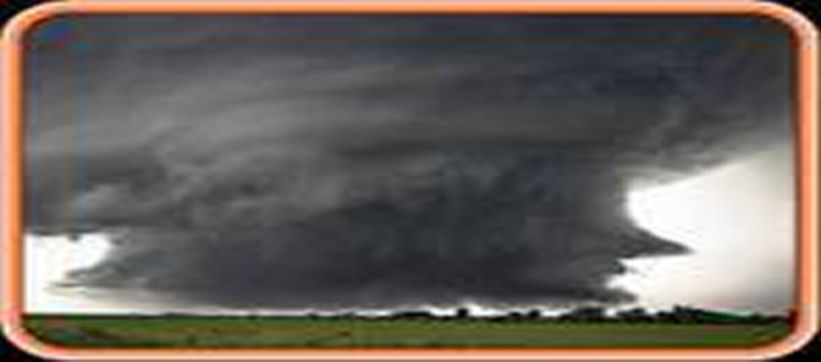
WEATHER - More than just rain or snow.

Red Sky in the Morning -  Sailor take Warning;

If the rain’s before the wind, Tops’l sheets and halyards mind (or get a reef in the main quickly there mate!!)

If the wind’s before the rain, Tops’ls soon you’ll set again (shake out that reef mate quickly there!!)

A sharp rise after a low promises a harder blow! (Keep an eye on that Barometer there matey!! and stay in port and drink rum)

Weather is the single most influence on  sailors and boaters.  For most boaters, if it is raining, unless you’re a bass fisherman, you will not be going out.  If you’re a sailor, you want to know where the wind is coming from and at what speed.  Wind and rain, thunderstorms and snow are all weather phenomena.  The Portholes below will take you to a number of different weather sites, each offering information that you will find useful in your endeavors.

Chesapeake Bay - National Weather Service Forecast Areas - Upper and Middle Chesapeake Bay

Current Weather On the Chesapeake Bay:

Latest Annapolis, Maryland, weather conditions and forecast  Latest Mayo, Maryland, weather conditions and forecast 
Latest Solomons Island, Maryland, weather conditions and forecast  Latest Cambridge, Maryland, weather conditions and forecast 


Home

MORE WEATHER INFORMATION PAGES AND INFORMATION LOCATIONS


AccuWeather

Remote Sensing - Skytruth - Good Site for evaluations of natural events using satellite observations

EarthWatch SailFlow—Excellent site for short and long term wind forecasts.  A must for anyone on the water.
Hamweather SolarCycle 24 - More good information on space weather and solar influences on Earth's Weather
Iceage now - Tired of Global Warming?  Try Global Freezing Space Weather - Hey, it does affect your sailing and motoring about
Intellecast - World wide weather
Intellecast - Washington DC and Middle Atlantic
Unisys Weather Information-a complete source of graphical weather information
JET STREAM ANALYSIS - Great site from San Francisco State University. See the jet stream in motion. Weather Maps - Make sense of all of those "L" and "H" and other squiggly lines you see on the weather maps
Meteorological Handbook - Surface Observations and Reporting Wind and Weather—Eclectic Stuff
National Snow and Ice Data Center - Great information regarding the cold, snow and ice around the world including useful information for past climate conditions. WXNation-Weather Forecast, Radar, Live WebCams-Great site!
Ocean Weather Forecasts -   Covers all ocean weather conditions worldwide Very High Altitude satellite images
Office of the Federal Coordinator for Meteorology - The Office of the Federal Coordinator for Meteorological Services and Supporting Research, or also known as Office of the Federal Coordinator for Meteorology (OFCM), provides full coordination of federal meteorological activities.
Weather For You - Provides weather information for creating your own weather page for trip planning or your own web site.
Plymouth State Weather Center—Really Good Information  
Plymouth State Weather Center - Build your own weather map  
  Satellite Viewing - It is not weather but it is related. Enter your Zip Code and find out when and where those satellites providing weather and other informationmay be viewed from your area. Something else to do on those star filled nights at anchor on the water.


NOAA & NATIONAL WEATHER SERVICE LINKS
 
Chesapeake Bay & Vicinity NOAA-Chesapeake Bay--Sandy Point to North Beach NOAA - Paleoclimatology Information on climate in the U.S. prior to recording of information. Real science at work
Chesapeake BayThomas Point Station  - TPLM2 NOAA-Tidal Potomac and Real Time Buoy Data  
Chesapeake Bay Interpretive Buoy System - real-time weather and water observations

NOAA Weather BuoysWorld Map


NOAA's Most Popular Weather Web Sites


Aviation Weather Center
Aviation warnings and forecasts of hazardous flight conditions at all levels within domestic and international air space.

National Hurricane Center / Tropical Prediction Center
Includes the National Hurricane Center and provides forecasts of the movement and strength of tropical weather systems and issues watches and warnings for the U.S. and surrounding areas
National Weather Service
Weather, water and climate forecasts and information for the United States and its territories

Climate Prediction Center
Monitors and forecasts short-term climate fluctuations and provides information on the effects climate patterns can have on the nation.

National Climatic Data Center
Manages the Nation's resource of global climatological in-situ and remotely sensed data and information to promote global environmental stewardship; to describe, monitor and assess the climate; and to support efforts to predict changes in the Earth's environment. Provides certified weather data.

Ocean Prediction Center
Weather warnings and forecasts out to five days for the Atlantic and Pacific Oceans north of 30 degrees North.

Hydrometeorological Prediction Center
Nationwide analysis and forecast guidance products out through seven days.

National Oceanic and Atmospheric Administration
Agency of the U.S. Department of Commerce that is dedicated to enhancing economic security and national safety through the prediction and research of weather and climate-related events and providing environmental stewardship of our nation's coastal and marine resources.

NOAA Weather Radio All-Hazards
Immediate and reliable broadcasts of official weather and non-weather related alerts and information from local National Weather Service Forecast Offices to the public.
Space Environment Center
Space weather alerts and warnings for disturbances that can affect people and equipment working in space and on earth.
Storm Prediction Center
Tornado and severe thunderstorm watches for the contiguous United States along with a suite of hazardous weather forecasts. Technical discussions on the cause and impact of hazardous winter weather, excessive precipitation, and non-severe thunderstorms
NOAA -National Severe Storms Laboratory - Historical Weather Data Archives - provides online access to historical weather data archives including surface and upper-air data
NOAA - Paleoclimatology Information on climate in the U.S. prior to recording of information. Real science at work  

Global Observing Systems Information Center -The GOSIC Portal provides convenient, central, one-stop access to data and information identified by the Global Climate Observing System (GCOS), the Global Ocean Observing System (GOOS) and the Global Terrestrial Observing System (GTOS), the Global Atmosphere Watch (GAW) and regional observing systems, such as the GOOS Regional Alliances (GRA).


Current Surface Conditions Maps Jet Stream Analysis
Mid-Atlantic Surface Map Jet Stream Analysis with Satellite
Midwest Surface Map National 850 mb Map
New England Surface Map National 700 mb Map
Northwest Surface Map National 500 mb Map
Southeast Surface Map National 300 mb Map
Southern Plains Surface Map National 200 mb Map
Southwest Surface Map Northern Hemisphere
Surface Map from TWC Southern Hemisphere
Current Temperatures Northern Hemisphere 850mb
High Temperature Map Lifted Index Contour
Low Temperature Map Perceptible Water Contour
Heat Index 1000-500mb Thickness Contour

Out of this World Weather

NOAA Space Weather Prediction Center - Real-time and Near-real-time Solar Image Sites Atmospheric Optics - Learn what causes a rainbow or some of the other phenomena you may see in the sky The latest 48 hours of solar wind data
Spaceweather.com - News and Information about the Sun-Earth Environment The Aurora Page -  A source for Information, links and images about the "Northern Lights" Spaceweather Sounds - A place to hear the weather going on in space.
Space Weather Forecast Center - From Scientific Frontline


Uranus Live Weather and Weather Forecasts
Gadgets powered by Google
Sun Live Weather and Weather Forecasts
func

WIND - Beaufort Scale